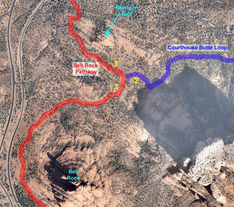
Aerial Map Showing the Bell Rock Pathway (red), the Bell Rock Trail (Light Blue) and the Courthouse Butte Loop (Dark Blue). The Northern Intersection of the Bell Rock Pathway with the Courthouse Butte Loop is Seen. The numbers on the Map shows the view of the respective trailheads: 1: Bell Rock Parkway to the North; 2: Bell Rock Parkway to the South; 3: Courthouse Butte Loop to the East.